Successfully conquering the limits of best friends is always attractive to everyone, which is also the reason adventure travel is increasingly popular. Therefore, conquering the beautiful and adventurous natural wonders is becoming a passion to test yourself today. The following Vietnam Reviewer will suggest you the most beautiful and adventurous tourist destinations in Vietnam, hoping to help you easily choose a tourist destination for each of your trips.
Table of Contents
Top 15 most beautiful adventure tourist destinations in Vietnam
Fansipan Peak
Fansipan communal house belongs to the Hoang Lien Son mountain range, about 9 km southwest of Sapa town. The mountain is bordered by two provinces of Lao Cai and Lai Chau in the Northwest region of our country. Fansipan is not only the highest mountain in Vietnam but also the “roof” of Indochina. With an altitude of more than 3,100 m, visitors can conquer this mountain by many different paths. If exploring in the “traditional” way, i.e. without using the cable car, it takes visitors 2-4 days to move.
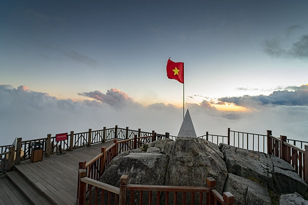
Fansipan is not only a famous peak of the beautiful mountains of Sapa, but is also known as the “city in the clouds”. Once here, you will realize that the Northwest mountains are majestic with famous architectural works such as the cable car system to an altitude of 3,000 m, Bamboo Garden, Bao An Thien Tu, Bich Van Thien Tu,… appear fuzzy, virtual in the clouds. So this will probably be a must-see for those who want to hunt for the best cloud photos.
- Address: Tam Duong District, Lai Chau Province
Tay Con Linh Peak
If you are a lover of heights and adventure routes of the high mountains of Ha Giang, in addition to Chieu Lau Thi peak above 2,400m high, you cannot help but fall in love with Tay Con Linh range all year round with frost and bitter wind. The steep pass is precarious along the successive mountain ranges to reach the top of Tay Con Linh.
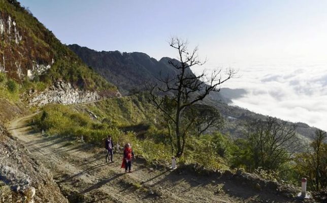
Tay Con Linh Peak is 2419 meters high and Kieu Lieu Ti Peak is 2402 meters high in Ha Giang province. Coming here, you have to go through the zigzag roads of adventure, one side is a deep abyss, and the other side is a high cliff. When coming here, visitors must definitely visit Xin Man district, hike Ma Pi Leng pass, visit the Lung Cu flagpole, and learn a little about the Lo Lo ethnic identity.
With the attention and investment of Hoang Su Phi district to exploit tourism along with the Chieu Lau Thi mountain range – Tay Con Linh Peak will be one of the beautiful places, a strength to exploit tourism by motorbike and route. ecotourism walking path, explore and experience the majestic beauty of the mountains here.
- Address: Phuong Tien Commune, Vi Xuyen District, Ha Giang Province
Lung Cung Peak
Lung Cung Peak is 2,913 m high with white clouds covered all year round, the name the mountain peak is named after a village located deep in the most rugged mountains of Yen Bai. Want to come here, visitors can climb from 3 different directions (from Thao Chua Chai village, Lung Cung village, or Tu San village). Before reaching the place of harmony between heaven and earth, enjoying the majestic beauty of nature, it will take you about 2 days to cross an arduous and dangerous road with primeval forests, up and down the cliffs. erect.
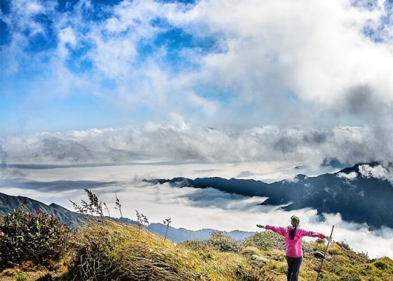
The climate here is very fresh with rich vegetation, in the vicinity there are also forest flowers such as azaleas, red maple trees, and some other flowers. But the most attractive thing is that this place still retains its pristine beauty and has never been affected by humans. In recent years, villagers have created tourist routes and guided tourists to climb Lung Cung Peak to conquer and explore this peak. A number of tour operators are conducting trekking tours for travelers who like adventure and experience.
- Address: Nam Co Commune, Mu Cang Chai District, Yen Bai Province
Nam Kang Ho Tao Peak
As one of the most dangerous places in the Northwest high mountains, Nam Kang Ho Tao has a long climbing route. Here, visitors have to overcome dangerous rock climbing stages. In some places, the cliffs are soaring, smooth, and without any ledges while below are streams and boulders.
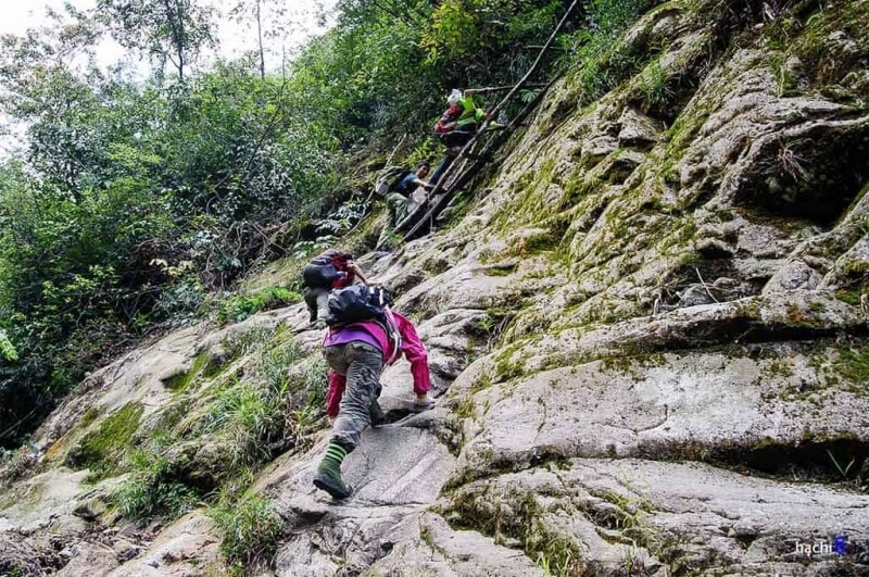
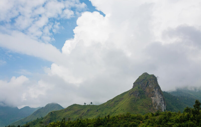
Possessing an altitude of 2,881 m above sea level and is not in the Top 10 highest mountains in Vietnam. This is one of the super beautiful roads that few people know about. Not only that, Nam Kang Ho Tao is likened to a “forgotten place”. Because of the steep, slippery cliffs interwoven with dense forests, shielding and covering all the paths, … Along with that are the streams that are lonely when flooded, full of danger. However, all those scenes of unspoiled beauty bring a special attraction that makes adventure-loving tourists hard to resist.
- Address: Ban Ho Commune, Sapa District, Lao Cai Province
Ca Pass
Ca Pass is the longest adventure road in the Central region located between the two slopes of Hao Son and Da Bia mountains with an altitude of more than 330m with a total length of 12 km connecting Khanh Hoa province with Phu Yen. The winding mountain passes the road winding like a giant snake and challenges the bravery of those who love to explore and conquer. Passing the Ca pass, you feel like you are enjoying a feng shui picture with one side of the mountains, forests, and fields peeking out from the green grass, the other side is the clear blue sea with countless boats moored.
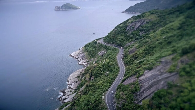
Going up and looking back, you will see the roads that have just passed off the Ca Pass winding and winding, just like a giant python crawling on a mountain. When moving through the pass roads, you will admire the majestic scenery of Ca Pass with a picture of water and mountains, one side is an immense blue sea, and one side is high mountains and forests, all in harmony with the surrounding. Heaven and earth create a charming scene that any visitor passing through the pass also wants to stop to enjoy and flutter before the wild and poetic beauty of this place.
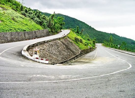
If you accidentally pass through this pass in the contemplation season, you will be able to see the vast fields of ripe yellow rice gently gliding in the wind like extremely wonderful waves. The nature and climate here make anyone passing by here ecstatic.
- Address: Hoa Xuan Nam Commune, Dong Hoa District, Phu Yen Province
Ta Nang – Phan Dung
Ta Nang-Phan Dung goes through 3 provinces of Lam Dong, Ninh Thuan, and Binh Thuan, and is known as the most beautiful road in Vietnam. However, this is a very difficult tourist destination to conquer and is especially dangerous in the rainy season because of the high mountainous terrain.
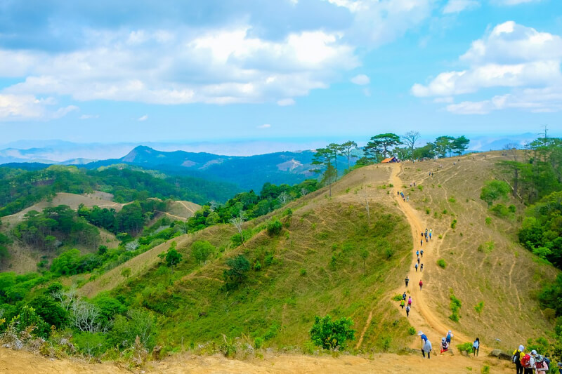
This route has a total length of about 55km, surrounded by forests, mountains, and beautiful, wild streams. However, when conquering this Ta Nang – Phan Dung road, backpackers not only need to be physically fit but also have to be fully equipped with survival skills, respect for nature, and a plan to cope with the weather. Many unfortunate accidents that have happened here are the alarm bells about the safety of those who set foot in this place.
- Address: Ta Nang Commune, Duc Trong District, Lam Dong Province
Mrs. Black Mountain
As one of the highest mountains in the South, Ba Den Mountain (Tay Ninh) is always a favorite destination of backpackers or mountaineering enthusiasts. From the foot of the mountain to Dien Ba – the position in the middle of the mountain with the temple system, the pagoda has 3 transportation options: cable car, slide, and walking. Each option takes about 20-60 minutes to travel.
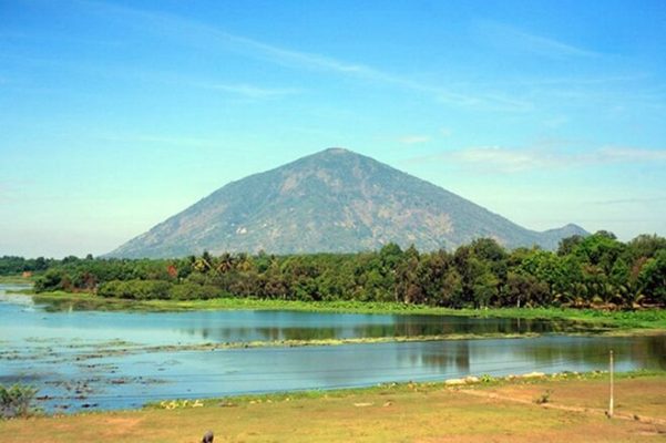
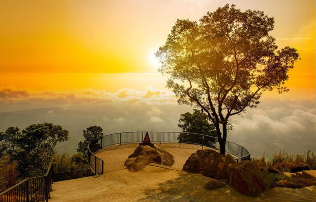
However, from Dien Ban to the top of the mountain, there is only one option which is to follow the trail behind Dien Ba. Visitors have to weave their way through rocks and caves to reach the top. This stretch of road has extremely complex and dangerous terrain. Sometimes, visitors will encounter avalanches or poisonous snakes on the mountain.
- Address: Thanh Tan Commune, Tay Ninh Province
Lao Than Mountain
Dubbed the most beautiful place to hunt clouds in Y Ty (Lao Cai), Lao Than Mountain is a beautiful tourist destination favored by backpackers. But to get here, visitors will have a hard time crossing because the road has many shrubs, strong wind, hot sun, and water scarcity. Besides, despite the trail, there are many turns with twisty roads and steep slopes. Therefore, tourists need to hire local people to guide them to avoid getting lost in the forest.
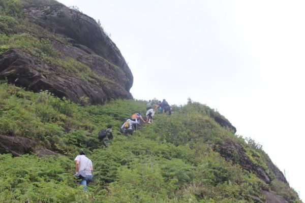
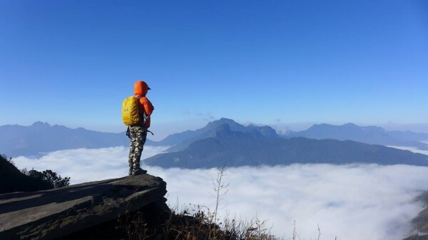
For young people who like to hunt clouds, the road on Lao Than Peak with an altitude of more than 2,860 m in Y Ty commune, Bat Xat district, is considered a reasonable choice in this winter-spring weather. Lao Than is also known as Nhiu Co San father (distinguished from Nhiu Co San in the opposite direction), or the Mong people call the mountain Hau Pong San. During the climbing journey, which brings many emotions to visitors, there are some steep sections, many thorny shrubs, and “virtual living” spots such as dry trees, or precarious cliffs.
In particular, if visitors go into the cold air, they will also encounter the scene of frost covered with trees and grass on the way up the mountain. At that time, trekking visitors will feel the cold air pouring into the northern mountains, making many places submerged in ice.
- Address: Trinh Tuong Commune, Bat Xat District, Lao Cai Province
Explore caves in Quang Binh
Quang Binh is one of the outstanding destinations for adventure tourism in Vietnam because there are tours to explore the extremely rich cave system in Phong Nha – Ke Bang National Park. In particular, there is Son Doong Cave, “the largest natural cave in the world”, which has been many times featured in international magazines and media programs. There are many caves and natural areas in Quang Binh that adventurous tourists can explore such as Phong Nha cave underground river, Thien Duong Cave, En Cave, Tien Cave, Tu Lan Cave, etc.
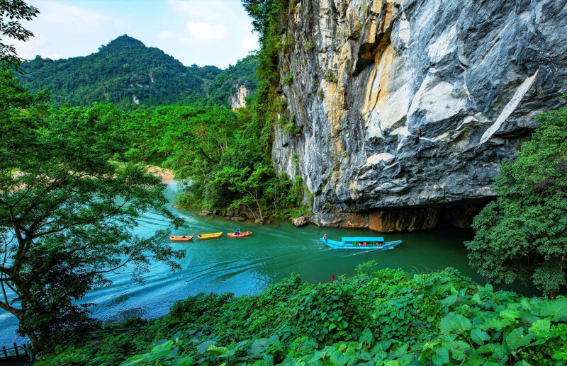
In particular, Phong Nha belongs to the Ke Bang limestone mountains located at. This place is called “Thien Nam De Nhat Dong” with beautiful scenery, sheltered by tropical forests all year round. Phong Nha Cave has a length of 7,729m, a depth of 83m, and a height of 50m and is divided into many sub-cave branches such as Bi Ky Cave, Tien Cave, and Cung Dinh Cave. This is an underground water cave in the heart of the mountain, there are many typical stalactites that make visitors go from one surprise to another.
- Address: Son Trach Commune, Bo Trach District, Quang Binh Province
Ban Gioc Waterfall, Cao Bang
Located in the northeast of our country, Cao Bang is blessed with rich tourism potentials such as majestic mountains, forests, rivers, and streams, nature still has many wild and primeval features. Coming to Cao Bang, you will not be able to miss the opportunity to see and conquer Ban Gioc Waterfall – the fourth largest waterfall in the world among the beautiful waterfalls located on the border between countries and a large natural waterfall Southeast Asia region.

Viewed from a low angle, the waterfalls like silk ribbons captivate many visitors and photographers. September and October are the ideal time to explore Ban Gioc waterfall, when the water is abundant and clear, the waterfalls are flowing with white foam. At the waterfall, visitors can rent bamboo rafts from people to visit around, for about 50,000 VND per person.
- Address: Dam Thuy Commune, Trung Khanh District, Cao Bang Province
Datanla Waterfall, Dalat
Datanla Waterfall has an abundant amount of water because the upstream is a stable source of water. Datanla is not noisy due to flowing through many stone platforms. The waterfall falls from the rapids 20m high, and the spring water in the lower part forms a very clear water area, so it is called Suoi Tien, and the upper part has a deep abyss called the Death Valley.


At Danlanta waterfall, there is an interesting rope swinging service. To participate in this game, players will be guided by different difficulty levels. Initially, it is a dry waterfall practice from 15-18m, followed by a short waterfall and then a 25m high waterfall. The difficulty will be gradually increased according to the player’s adaptation. Joining this game, you can also float on the worn rocks or jump into the water hole from the cliff… It’s not just about overcoming the feeling of precariousness and fear when standing in the middle of the cliff line. Standing Rock, visitors also have to face extremely strong currents of water pouring directly into their faces and people.
- Address: Highway 20 Prenn Pass, Ward 3, Da Lat, Lam Dong Province
Pu Luong – Thanh Hoa
Pu Luong Nature Reserve is located in the Ba Thuoc and Quan Hoa districts, located in the northwest of Thanh Hoa province, 130 km from the center of Thanh Hoa City. With stilt houses on both sides of the mountain, hidden under the protection of majestic mountains, Pu Luong can be said to be the best place to climb and discover the hidden beauty of the western border.


June or October is the most beautiful time in Pu Luong, when the rice is ripe and golden on the terraced fields on the hillside, adorning the green carpet of Pu Luong with a rich, peaceful, and poetic look. The most interesting point when traveling to Pu Luong is to save the moments of immersing yourself in nature in the middle of the rice season, especially in June or October when Pu Luong is covered with golden yellow. This is a great time for you to go to Pu Luong.
- Address: Co Lung Commune, Ba Thuoc District, Thanh Hoa Province
Mai Chau – Hoa Binh
Mai Chau is a mountainous district in Hoa Binh province, a small valley located under Thung Khe Pass, where many Thai villages live. This is the destination of hundreds of thousands of domestic and foreign tourists every year to immerse themselves in nature and explore the life of the Thai people.
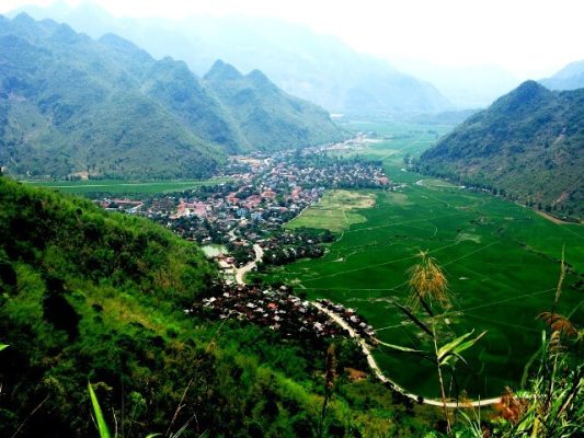
Coming to Mai Chau, you can go to Thung Khe Pass, not as majestic as O Quy Ho or Ma Pi Leng Pass, but dangerous because of the trucks going up and down every day and the thick fog every morning and evening. Not far from the center of Mai Chau town, close to National Highway 15, looking towards Lac village, Pom Coong village is Mo Luong cave, which is more than 500 meters deep in the mountain, including niches with a width of 1-30 meters, ceiling arches. has an average height of 10 meters, and even the highest is 30 meters. Or Chieu Cave with the way to the cave entrance is 1200 stone steps.
- Address: Mai Chau District, Hoa Binh Province
Ha Giang
Ha Giang is located in the northernmost part of Vietnam, our country has a rather complicated topography with many high rocky mountains and rivers and streams. Tay Con Linh Peak is 2419 meters high and Kieu Lieu Ti Peak is 2402 meters high. Ha Giang has many villages that still keep their culture almost intact. Foreign tourists come here, especially to the natural landscape in Xin Man district, hike Ma Pi Leng pass, visit the Lung Cu flagpole and learn a little about Lo Lo’s ethnic identity.
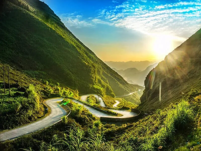
Coming to Ha Giang, you will see the first majestic view of Hoang Su Phi terraced fields in the ripe rice season, the valley of buckwheat flowers, and go through the dangerous but also very poetic roads of one of the four great peaks of the pass. Ma Pi Leng, or feel the peaceful and ancient life in Dong Van’s old town. The most beautiful tourist attractions in Ha Giang are scattered along the route from Ha Giang City to Dong Van, here are the most beautiful tourist attractions you should not miss on the journey to discover Ha Giang.
- Address: Ha Giang Province
Cat Ba
Cat Ba Island is an archipelago in the Cat Hai district, Hai Phong City. Located offshore and about 30 km from Hai Phong City. The North is Ha Long Bay, about 25 km from Ha Long City. Ha Long is recognized by UNESCO as a World Natural Heritage, while Cat Ba Island is recognized by UNESCO as a World Biosphere Reserve. Many people also compare this island to the pearl island of the North (like Phu Quoc pearl island in the South).

Formed by the forest and the sea, Cat Ba has long become an attractive place attracting a large number of domestic and foreign tourists. Despite this, Cat Ba still retains many natural and unspoiled landscapes thanks to its isolation. In Cat Ba, mountain climbing is a type of adventure tourism that attracts intrepid travelers. With 2 popular climbing places, Dau Be island after 2 hours by boat from Cat Ba tourist port and mountains in Ben Beo 2km from Cat Ba center, or Ba Trai Dao island 22 km south of the tourist port skyway.
- Address: Cat Hai District, Hai Phong
Related Article: Things to Know about Ba Vi National Park
Above are the most beautiful and adventurous tourist destinations in Vietnam. I hope that these suggestions will help you a lot in choosing tourist destinations for yourself and your loved ones. Especially for those who love to explore nature and love adventure. Wish you and your family a happy trip. If you have any feedback or need help, please send an email to vietnamreviewer.contact@gmail.com!

